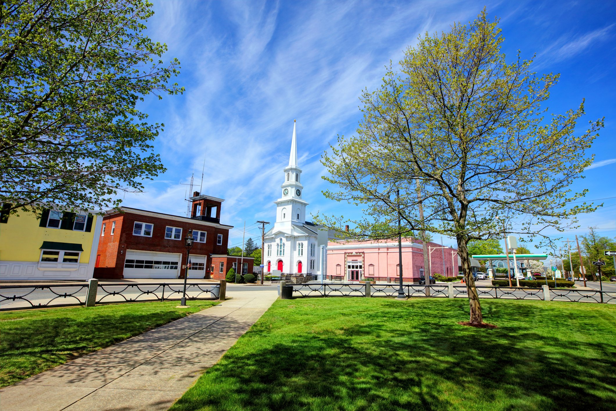
Building on Faith: Understanding Religious Land as a Housing Solution

Faith-based organizations have long played a central role in community care by feeding the hungry, sheltering the unhoused, and offering spaces of belonging. But what if they could do even more by reimagining how their land is used?

With affordable housing out of reach for most Americans, state and local leaders are searching for creative ways to expand what’s buildable.

A growing national movement called Yes in God’s Backyard” (YIGBY) seeks to empower religious institutions to repurpose underused property for housing, but the potential scale of that opportunity is hard to assess without clear data.

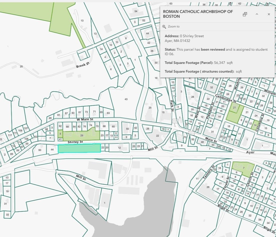
In Massachusetts, the Lynch Foundation needed answers:Logo of the Lynch Foundation

  • How much land do faith-based organizations own across the state?
  • Where is there space — vacant or underutilized — that could support development?
  • What’s the real, realistic potential for new housing?

Traditional approaches would have required time-intensive, manual research. Instead, a fast, accurate, and replicable assessment was needed. One that could inform policy, mobilize partners, and turn possibility into action.

WHO OWNS AMERICA

Bringing Ownership into Focus

Most public data sources miss the full picture of land ownership. Religious institutions often hold land through multiple entities (like churches, dioceses, affiliate nonprofits, clerics, and more), and ownership details can be buried in outdated or incomplete records. The Who Owns America® (WHOA) methodology cuts through that noise — using a novel, nationwide parcel-by-parcel classification to uncover the true scope of who owns what.

A white steepled church in Foxboro, Massachusetts.
OUR APPROACH

Accelerating Housing Solutions Through Smarter Data

To help the Lynch foundation rapidly and accurately identify land owned by faith-based organizations, the Center for Geospatial Solutions (CGS) developed a specialized ownership query to trace back ownership across jurisdictions. This process surfaced parcel records with obvious identifiers (like “Archdiocese” and “Latter Day Saints”) as well as more obscure indicators (like “archdio” and “rom cath”) to reveal nearly 6,000 properties owned by institutions of worship in the state, far beyond what standard land use codes or public records would suggest. 

Stylized map showing parcels owned by the Archdioscese of Boston.

We then: 

  • Built a digital verification app to empower student researchers and faculty at Boston College’s Joseph E. Corcoran Center for Real Estate and Urban Action to validate properties remotely using Google Street View
  • Trained the team to flag redevelopment potential (e.g., vacant lots, unused buildings) and eliminate false positives (e.g., cemeteries or properties owned by people named “Jesus”)
  • Enriched parcel-level ownership with zoning, buildable area footprints, assessed value, and program qualification details (like whether the property lies within MBTA community boundaries or a low income housing tax credit area) to analyze development potential in context 

    In just a few weeks, we moved understanding of religious land holdings in the state from a rough estimate to a decision-ready parcel dataset. A resource that policymakers, advocates, and faith-based leaders can use to make housing happen. 

LYNCH_yigby_googlestreetview


By the Numbers: Church-Owned Land

Thousands of parcels owned by religious institutions across Massachusetts. Millions of square feet of development potential. Real policy influence.

4500 +

Properties

Could support new construction or conversion across MA

462 M+

Square Feet

Estimated buildable area

80 K+

New Homes

Potentially supported by faith-based organizations in the state

4

Weeks

To deliver a precise, verified answer 

RESULTS THAT MATTER

Better Land Intelligence for Housing Solutions

This project gave state and local leaders a new lens on land ownership, turning hidden records into powerful tools for housing justice. It confirmed that faith-based land, when unlocked, could make a meaningful contribution to addressing Massachusetts’ housing needs.

Just as importantly, it showed that civic participation and public-interest data infrastructure can move fast, work affordably, and support systemic change engaging students, informing legislation, and helping mission-driven organizations act with clarity. 

Aerial image of a church along a river in the Connecticut River winding through the Pioneer valley region of Massachusetts.
Quotes

For the first time, we have a clear, comprehensive picture of how faith-based land could help address the housing crisis. CGS delivered exactly what we needed...fast, thoughtful, and ready for action.

Lynch - Katie Everett
Katie Everett
Executive Director, Lynch Foundation
What's Next?

Expanding Capacity to Meet the Moment

In response to Governor Healey’s 2025 Statewide Housing Plan, CGS is now helping the Lynch Foundation and its partners expand their capacity to understand development potential across the state through a custom, decision-ready parcel data platform.  

By fusing public data with mission-aligned insights, CGS is helping the Lynch Foundation lead with clarity — and act with precision — in a rapidly evolving housing landscape. 

Image of Trinity Church in Boston.

Let’s Uncover What’s Possible— Together

Whether you’re a policymaker, planner, foundation, or faith-based organization, CGS can help you make sense of land use and ownership.